


My last excursion in Israel’s South took me into the desert: First, I explored ancient Avdat and then I went in search of an oasis to Ein Akev.
The Negev Desert covers more than half of Israel’s land mass — from Beer Sheva in the North to Eilat at the Red Sea. The Hebrew word negev can be translated to dry or South. However, not all of it is desert; some parts are semi-arid. The Arabic name for the Negev, Naqab, means ‘mountain pass,’ which seems just as fitting as mostof the land is covered in rock rather than sand dunes.
Historically, the Nabateans of Petra fame roamed the Negev as part of the Incense Route that ran from the tip of the Arabic peninsula in Yemen to Gaza at the Mediterranean. That is why you will find numerous ruins dotted about and relatively accessible by car along Route 40.
Not having my own vehicle available, I decided to visit only one place. Avdat, perched on a hill above Route 40, comes with a convenient bus stop for buses #64/65. For navigational purposes, I’m also going to mention that there is a McDonalds next to the National Park visitor center. It’s hard to miss the golden arches when looking for your stop.
Table of Contents


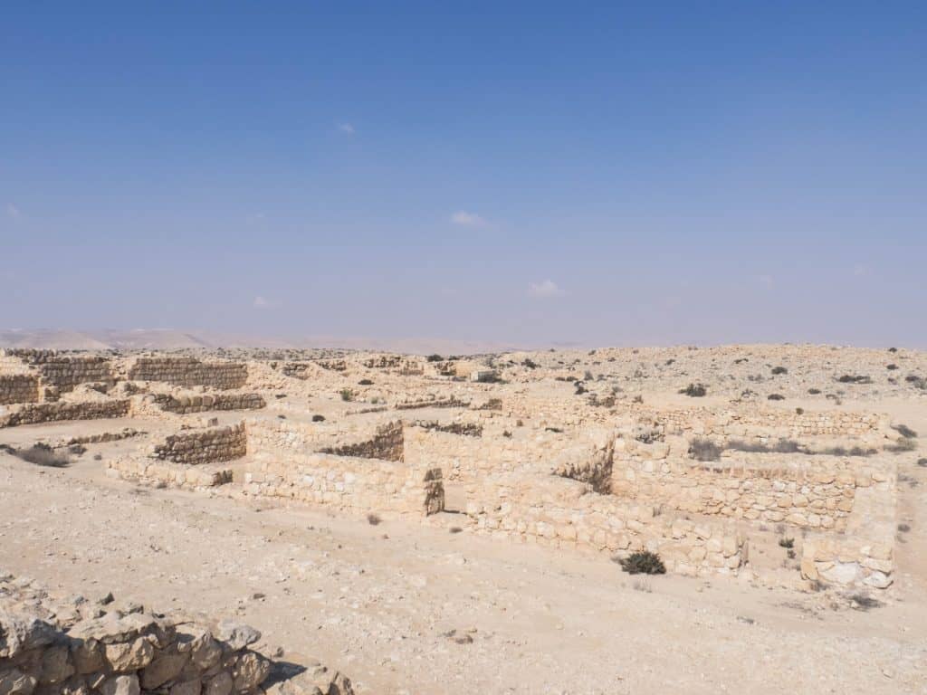
Avdat is one of the best-preserved Nabatean cities in Israel. It existed for a thousand years, built under the Nabataeans and continued into the Byzantine era until a strong earthquake led to the abandonment of the city. It is not only unusual for its buildings but also for the system of wells making agriculture in this dry landscape possible in the first place.
Along with other desert cities and the Incense Route, Avdat was declared a UNESCO World Heritage Site in 2005.
When I arrived on a Thursday morning in February, I was the only visitor at the visitor center. The clerk sold me my ticket and advised me on hiking routes. Then I watched a 10-minute intro video to the old Nabatean city.
Armed with a map, a camera and 3 l of water, I started climbing into Avdat:
Past the well-preserved Byzantine bathhouse with a deep well, along the dwellings and store rooms hewn in the rock, up to the wine press and the Roman Tower with a magnificent view over the lands. Below me, I could see where 2,000 years ago, Romans had created fields in the desert building on the Nabateans unique skills of collecting and storing even the smallest bit of water the desert yielded.


I explored the old city for about an hour before setting out on the hike I had come for: to find Ein Akev spring.
If you have more time make sure you check out the Roman Villa and Even-Ari Farm, which attempts to reconstruct the ancient farming methods and water storing methods. There is also supposed to be a grave hewn into the rock with a facade comparable to Petra. However, I was not able to get any information from locals as to how to find it.
Note: You do not have to pay the NIS28 entrance fee to Avdat if you are not interested to see the old city. Instead, start your hike from the green path a few meters north of the McDonalds (along the road towards Beer Sheva).


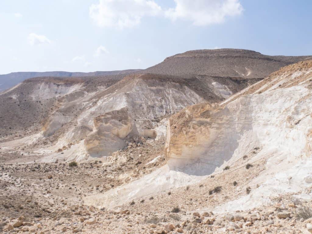
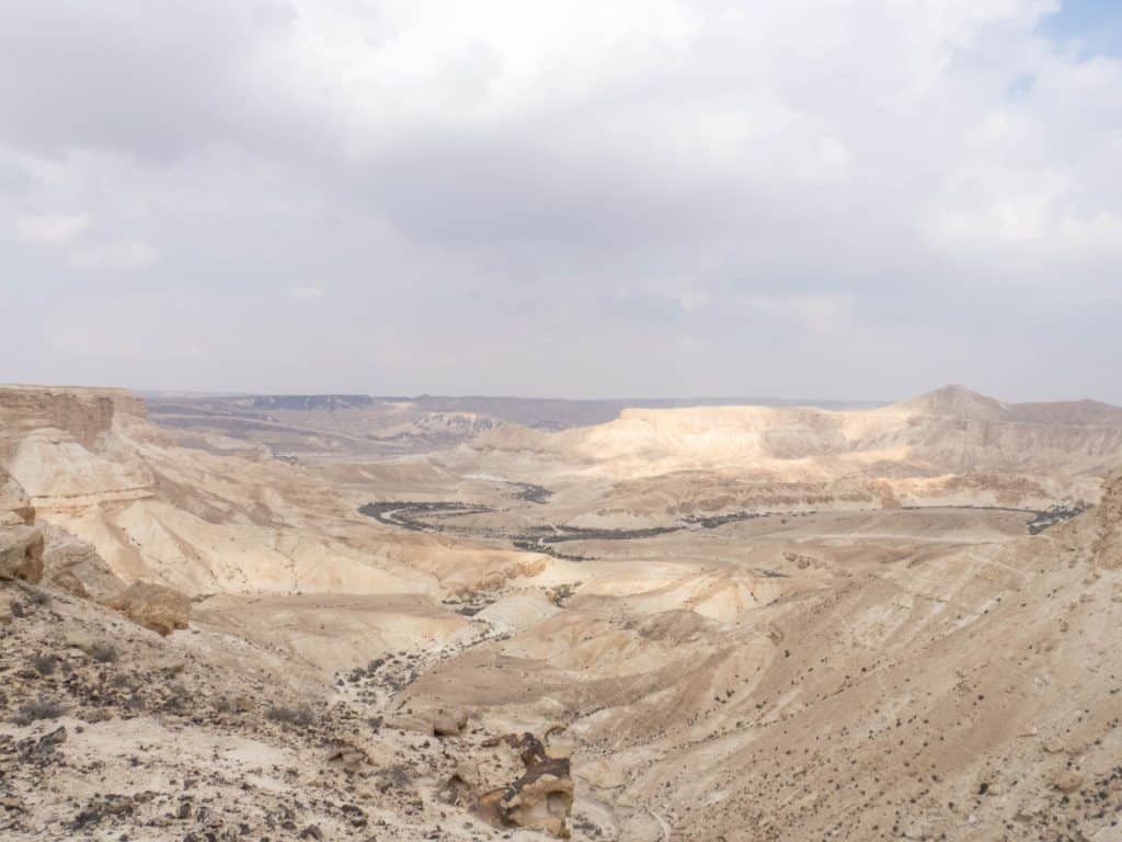
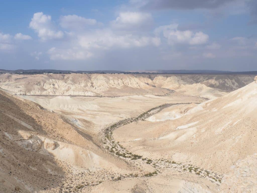
Avdat is located on one of the largest plateaus in Israel, the eponymous Avdat Heights. Avdat Heights is cut through by many canyons. Some of them have springs in them.Ein Avdat and Ein Akev are the biggest ones and favorite spots for a swim in the hot summer months.
Note: Hiking in the summer is not recommended as temperatures can easily reach 40°C, and shade is rare in the Negev. Follow the locals’ lead and use a jeep to get to the pools instead.
Color-coded paths once again make following my route fairly easy. Since I’m hiking on my own, I pay special heed to the words of the visitor center’s clerk: “Look out for the next marker or two from the current marker. If you can’t see them, go back to the last marker and start over.”
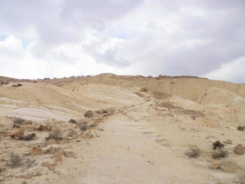
I follow the green trail from Avdat past the Roman Army Camp until it meets the blue path. Down the hill, the blue stripes flanked by two white stripes are easy to find. Bedouin tracks cross and disappear.


Two small valleys later I discover the green band emanating from the Upper Akev Spring (Ein Akev Elyon). After two hours of walking, I finally meet two other hikers. Big backpacks with sleeping mats attached to them on their backs, I guess they are doing the multi-day Negev Trail. But there is no exchange. They don’t seem to notice me and my “Hi!” when they pass me. the
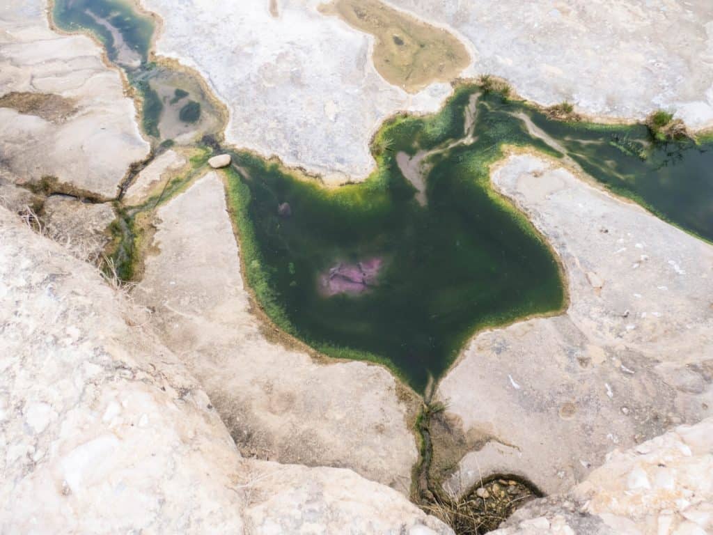
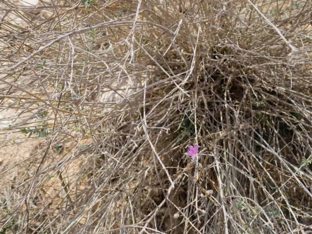
Down at the spring, I enjoy the fresh water gurgling from the ground for a little bit. Where it’s standing in small pools, greenish-brown growth makes the water look murky. But it is fresh and nourishes not only high reed groves but also a herd of ibex blocking my path.

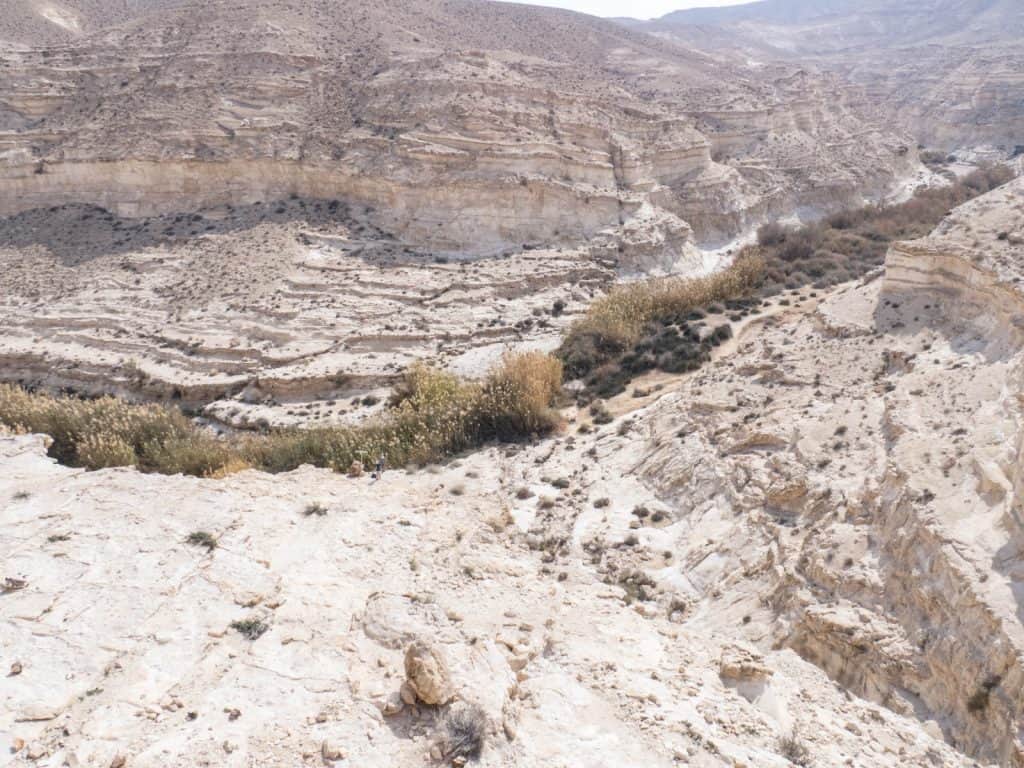

I turn right and follow the wadi. Looking up the steep walls sometimes closing in on me, I imagine how once upon a time a river swept through the valley. Now, the water disappears into nothingness, sucked up by the thirsty dry air where the hot sun touches it.
Sometime in-between the markers have turned black.
After another hour, the canyon opens up, and in the distance, I see the plateau drop abruptly.
When I get closer, I notice palm trees.
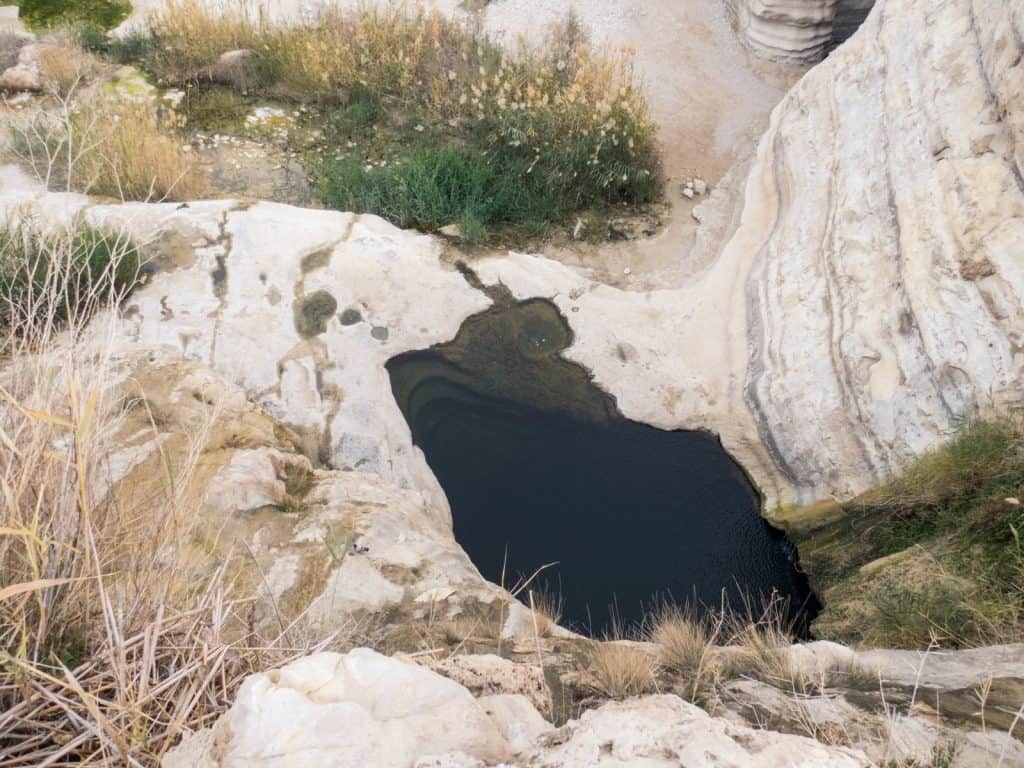
Looking down from the edge, I see a dark, deep pool of deliciously fresh looking water.
But I cannot see how to get down there. So I follow the edge as it slowly lowers itself towards the ground below, and then turn back to the pool.
There is a handful other people here who look at me like I was an alien. They have come here by jeep or walked from Sde Boker along the jeep track.
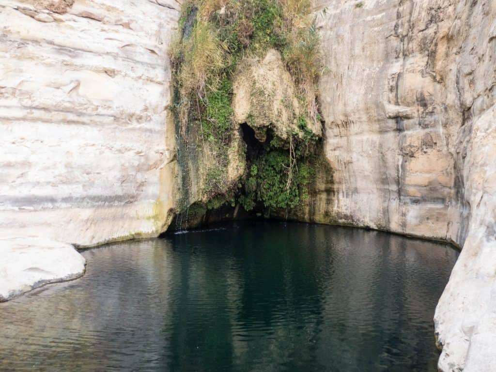
The spring water gushes from the rock like a waterfall surrounded by lush green ferns. Pigeons emerge from below the overhand the plants have created. A few meters on, I discover a large lump of soil and brown plant matter giving an idea of the force the water must develop on the rare occasions when rains turn the wadi into a river bed.
I dip my toes into the water. It is freezing. Despite sweating after hours in the baking sun, I skip the dip in the pool. A German couple doesn’t test the water and just jumps in. Their high-pitched screams prove me right in my assessment of the water temperature.
I debate whether to also follow the jeep track, an easy 1h walk in a valley, without major climbs. But I have been told that the walk along the plateau is stunning and that there is a Bedouin selling labneh yogurt with pita bread.
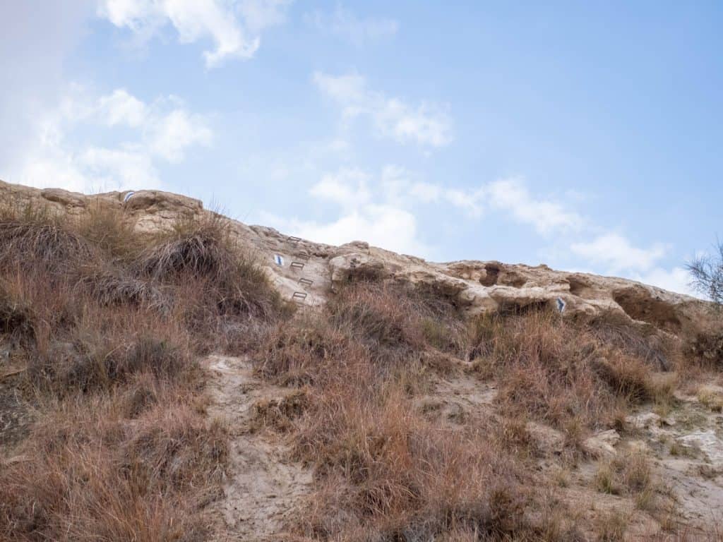
On my way back towards my path along the plateau, I discover markers in the wall to my left. They point up and end in metal handles driven into the rock as a ladder. The rock is slightly slippery with water trickling out but eventually I make it back up to where I had first discovered the springs and the pools.
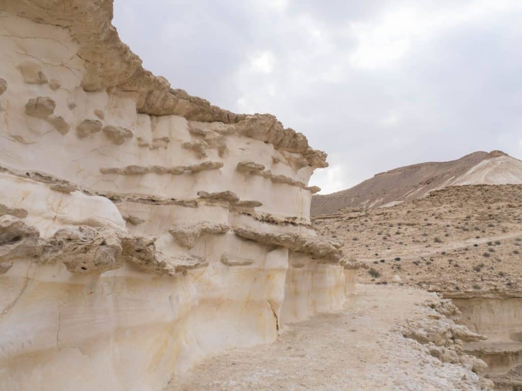
The path is now marked in green and takes me further up along Divshon Pass (Maale Divshon) with a rock wall to my left and stunning panoramas to my right.


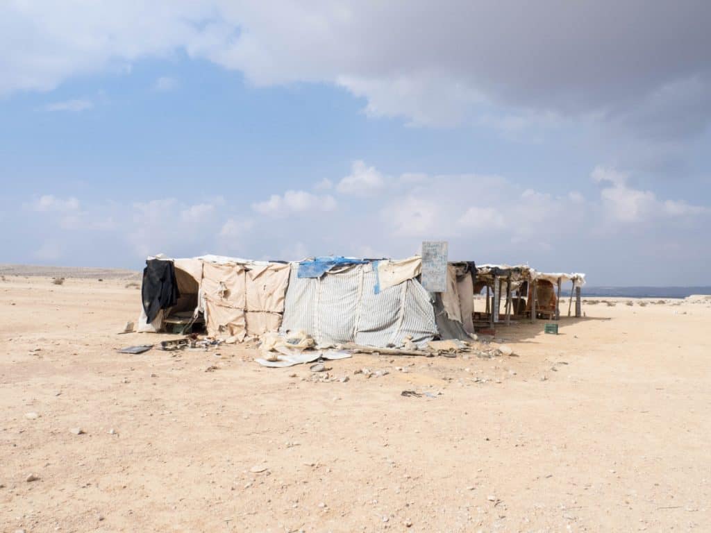
Another hour later, I see makeshift tents on a tableau to my left. They are Bedouin houses. The one with the labneh and pita is quickly found but empty. A sign advises calling the owner in via a local number. But I don’t have an Israeli SIM. So I miss out on the snack and continue along the plateau edge until I see Sde Boker on the other side of the canyon.
The canyon needs to be crossed and the last descent is the most challenging of the hike: It is steep and covered in loose gravel. Some parts are ridges with drops left and right.
I tread carefully and take my time.
Once in the valley, I don’t get to enjoy my feat for long: On the other side, an equally steep incline wants to be scaled.


Practical information & links:
- You can find more info on Avdat National Park and the ancient city of Avdat here: parks.org.il/sites/English/ParksAndReserves/avdat
- For more on hiking trails in the Negevcheck out the Negev Trails website: negevtrails.com
- If you have a car, access is straightforward. Avdat is at Route 40.
- Buses stopping in Sde Boker: #64, #55, #60 (#65 stops just outside Sde Boker on Route 40)
- Check here for a list of all routes and schedules around the Negev Desert (ignore the fare info, though): https://www.bus.co.il/otobusimmvc/Metropoline_Lines.
- For public transport from/to Tel-Aviv, Beer Sheva and Eilat, check my post on Ramon Crater (scroll to bottom): http://notesontraveling.com/2017/03/05/negev-desert-mitzpe-ramon/
- Do not forget that there is no public transport between Friday afternoon and Saturday afternoon because of Shabbat.
- Hitchhiking:
- Hitchhiking is very common in the desert and also works during Shabbat.
- Simply stop somewhere the cars can easily stop (wide shoulders or bus stops work fine) and point two fingers towards the road.
- Do not attempt to walk and hitchhike at the same time — you will be ignored.
- Split up groups of more than three people.
- Accommodation:
- Accommodation in the area ranges from guesthouses in Sde Boker Kibbutz to hostels in Mitzpe Ramon to hotels.
- For spontaneous peeps: Between Sde Boker and Avdat, you’ll see several guesthouses advertised that are just a few hundred meters off Route 40.
- Planning ahead? Feel free to use the search box below to find your accommodation.
